New Relationship Tracking System

FOR IMMEDIATE RELEASE
December 21, 2024

DEPARTMENT OF INTERPERSONAL AFFAIRS ANNOUNCES GROUNDBREAKING AUTOMATED RELATIONSHIP TRACKING SYSTEM

WASHINGTON, D.C. – The newly established Department of Interpersonal Affairs (DIA) is proud to announce the implementation of the National Relationship Intelligence System (NRIS), a revolutionary program that automatically detects, classifies, and monitors all interpersonal relationships through advanced mobile device tracking and artificial intelligence.

Starting January 1, 2025, all Americans’ romantic relationships will be automatically assigned a unique 16-digit Relationship Identification Number (RIN) based on comprehensive analysis of their smartphone location data, messaging patterns, heart rate variations, and social media interactions. This innovative system eliminates the need for manual relationship registration by leveraging the power of ubiquitous surveillance.

“Love shouldn’t be complicated – it should be automatically detected, classified, and monitored,” said Richard Bureaucraft, Secretary of Interpersonal Affairs. “With the new RIN system, we’re bringing the efficiency of social media algorithms to your love life.”

Key Features of the NRIS:

  • Real-time relationship status updates based on proximity patterns and text message sentiment analysis
  • Automatic detection of potential romantic connections through cross-referenced location data
  • AI-powered measurement of relationship health through voice stress analysis during phone calls
  • Predictive breakup alerts based on changes in communication frequency and emoji usage
  • Automated classification of “just friends” vs. “more than friends” using machine learning
  • Blockchain verification of relationship timelines
  • Neural network detection of potential infidelity through anomalous location patterns

The DIA has established a new Advanced Relationship Monitoring Center (ARMC) where AI systems continuously process data from millions of smartphones to maintain an up-to-date national relationship database.

“Gone are the days of relationship uncertainty,” explained Deputy Secretary Jane Redtape. “Our quantum computing systems can now determine your relationship status with 99.9% accuracy before you even know you’re in one.”

The system includes specialized algorithms for modern relationship scenarios:

  • Friends with Benefits Detection Protocol (Pattern FWB-101)
  • Situationship Classification Algorithm (Pattern SIT-202)
  • Ghost Prediction System (Pattern GPP-404)
  • Dating App Success Probability Calculator (Pattern DAP-303)

The department emphasizes that all relationship statuses are now automatically updated in real-time. The “talking phase” is detected within 72 hours of the first Instagram DM, and “exclusive” status is automatically confirmed through analysis of shared location patterns and changes in social media behavior.

Citizens need not take any action, as all relationship data is continuously collected through their existing digital footprint. Those attempting to evade relationship monitoring by using flip phones or meeting in person without mobile devices may be flagged for suspicious behavior.

For more information about how your personal data is being used to track your love life, visit www.dia.gov/love-surveillance.

Contact:
Office of Public Affairs
Department of Interpersonal Affairs
(202) xxx-xxxx
[email protected]

#

Note: This press release has been automatically generated and approved by the Neural Network for Bureaucratic Communications (NNBC-555) and the Artificial Intelligence Redundancy Intelligence.

This is also satire to show how absurd it is to create newer and newer ids to track citizens like the new Apaar id announced by the Government of India.

Also mainly written by Claude.ai

A walking, cycling/running highway for Bengaluru

Bengaluru has numerous lakes and parks. Known as a garden city, we all love walking and running in these parks. The city still maintains a good amount of green cover and trees along regular roads as well.

Despite the great weather and gardens, the city lacks proper walking, cycling, and running infrastructure. Daily walking for errands is nearly impossible due to broken sidewalks, exposed wires, and construction debris everywhere. Attempting to use a bicycle or run on the roads puts one at risk from heavy vehicles, cars, and stray dogs.

While the weather has traditionally been good, in recent years, due to climate change, it has been worsening. Summers have become unbearable, like this year when many of us struggled to survive without fans or air conditioning. During monsoon months, roads flood almost every time it rains.

The solutions to these problems are well-known. To prevent flooding, we should preserve lakes and avoid encroaching on storm water drains (rajakaluves or SWDs). These SWDs are not cleaned regularly and emit foul odors. The law mandates a 25m buffer zone on both sides of SWDs, but these areas are frequently encroached. Due to lack of maintenance, flooding has become an annual occurrence during monsoons.

To address heat related issues, we need more trees. We also need shaded areas for outdoor workers to rest and hydrate. These facilities do not exist today.

What about an elegant solution that addresses the need to keep SWDs clean, makes creative use of the buffer zone and prevents encroachments?

The solution is to create green paths around these SWDs for walking, running, and cycling. These should include greenery, rest areas, and drinking water facilities. Having a walking path will ensure that the SWDs are well-maintained. Encroachments will be cleared to build these paths, which will also prevent future encroachments.

The cycling path should have a shaded area created by a solar roof. The path will allow runners, walkers, and cyclists to use it safely. It should have greenery on both sides, provide drinking water facilities, outdoor exercise equipment, and toilets (rest spots) at regular intervals, and should be cleaned frequently. The path will also connect various parks within the city and important urban areas.

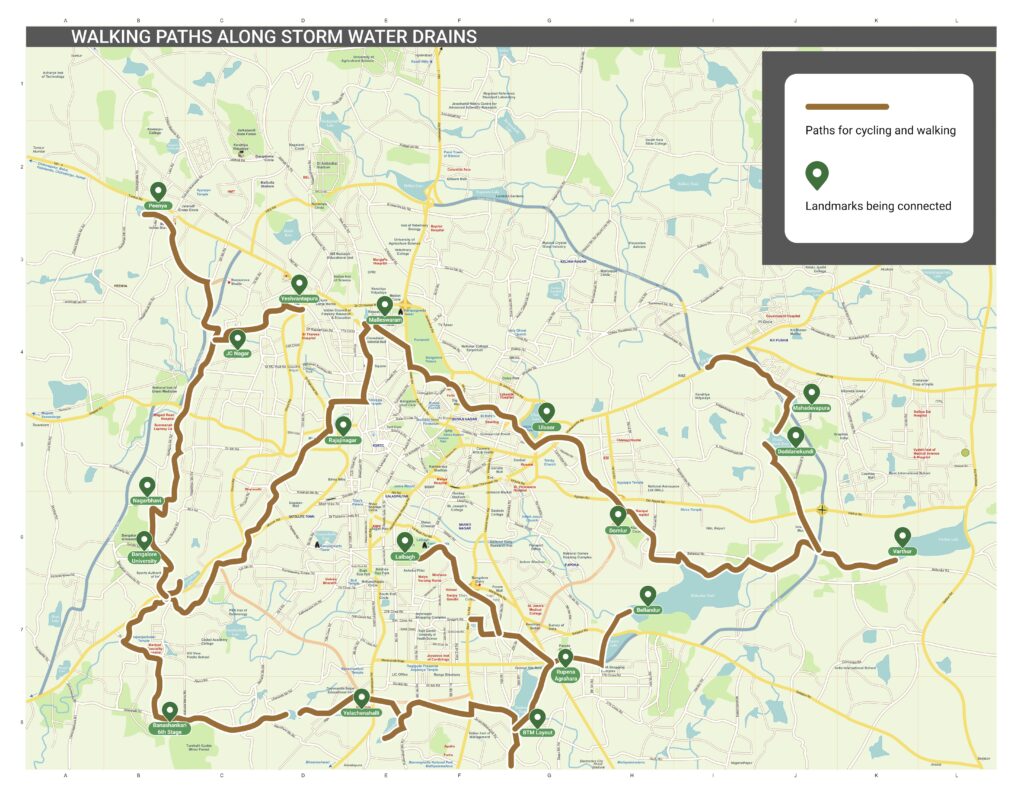
I’ve consulted the SWD map of the city and created a draft map of the path. The route incorporates major SWDs I could identify in Bengaluru.
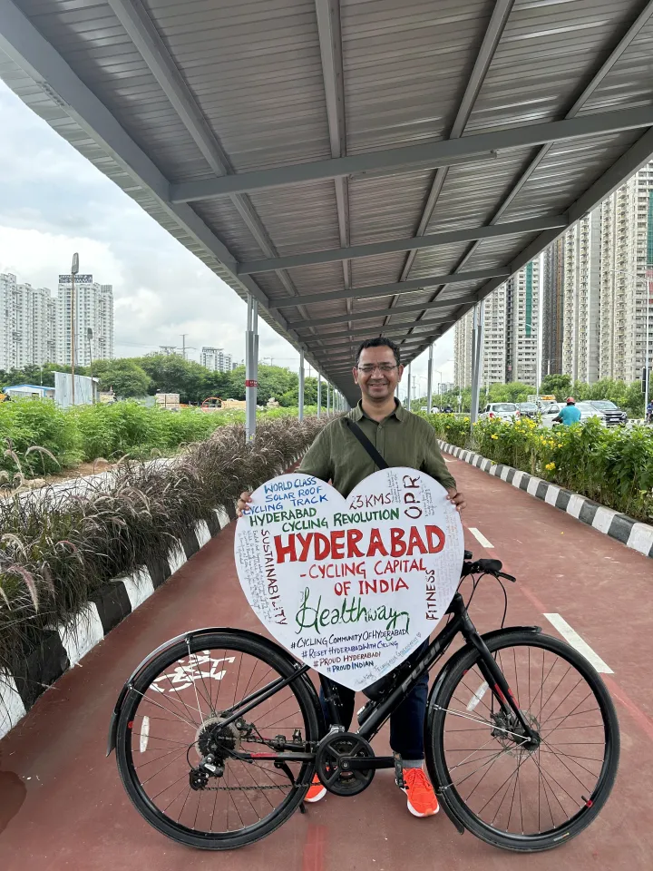
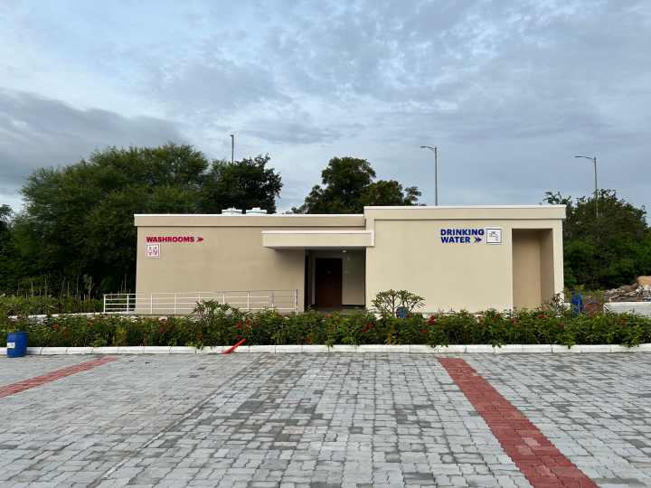
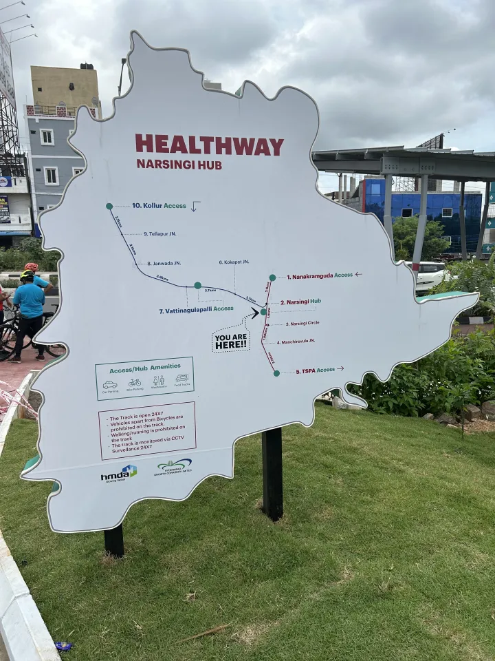
Similar projects are being built around the country. One example is the cycling path in Hyderabad. Look at the pictures from that path to imagine how it might look when built here. This post here has good information about this cycling path.
Another advantage of this path is that it will create a walking, running and cycling highway for Bengaluru. People who want to travel to different parts of the city without dealing with traffic can use these paths to commute easily.

Runners who have complained about the lack of long-distance paths in Bengaluru can now run a full marathon of 43 km (or even an ultra of 50 km) solely on these paths.

This will also serve as a rest area during the day for people who work outdoors.

I can anticipate several challenges:

  1. These spaces are already encroached upon and will be difficult to clear.
  2. There’s a risk that these paths might be used by motorized vehicles.
  3. The problem of stray animals (dogs, cows, buffaloes) will persist.

I believe we’ve achieved many great things in Bengaluru not because they were easy, but because many citizens wanted them and made them happen. I feel this is another idea whose time has come. If we work together, we can create an excellent walking, cycling, and running infrastructure for our beloved city.

Do you have ideas on how to take this forward?”

Musings from IndiaOS

Folks from Zerodha and ERPNext organized the conference IndiaOS (india open source) conference in Bangalore. IndiaOS brought together the open source projects originating in India and also the supporters of these projects. Here’s a quick summary of what I saw and what I hope to see in the coming editions of IndiaOS.

  1. The frappe framework is an open source framework used by ERPNext and Zerodha. ERPNext which is also an open source ERP built using Frappe framework. I was not aware of this framework until this event. I will certainly use this framework for my future projects knowing that the community is right here.
  2. Dr. Kailash of Zerodha also spoke about their usage of FOSS. It was impressive to see their commitment to FOSS. Here is a tweet with information about their tech stack.

  3. Handwriting recognition for Malayalam: This is a project by Indic Project. They have built handwriting recognition software for the Malayalam language. They are looking for contributors to extend this to more Indian languages.
  4. The story of how volunteers used open source software during the Kerala floods to coordinate the rescue efforts. The entire backstory is available here.
  5. The last talk of the day was by Apar Gupta who opened up the definition of open to include internet freedom. This entire post was inspired by his talk. He spoke about the work of the internet freedom foundation. He wanted us to look at the issue of internet blockages in India and how it affects democracy.
  6. A Malayalam newspaper which publishes their paper completely using open source software. They have made a lot of open source contributions themselves. Here is a tweet that shows their before and after tech stack.

After listening to the talks and the energy in the room, I felt that this event was a huge success. The folks who attended the event were also folks who are doers and optimists who want to make a difference. In this spirit, I feel that the next event should include talks from these folks (or folks who can cover these topics):

  1. Open Hardware: There was a talk about open hardware at IndiaOS. Next time, we should have some workshops covering the open hardware movement with hands on sessions.
  2. Open Communications: This was covered well by Apar in his presentation. We should include work around amateur radio and mesh networks which can help continue communications during times of internet blockade. This is also very much in tune with the times since internet blockade seems to be everywhere.  Workshops on Ham Radio and mesh networks will help people to communicate at times of internet shutdowns.
  3. Freedom and Society: This is a broad topic but I feel we should include folks like Meera working on good local journalism at Citizenmatters. Then there is the Citizens for Bengaluru, which is getting folks involved with working with government at the local level. Also should include folks like Capt. Manivannan who is working to get the government to be open in their communication and work with the public.
  4. Open Data: Here we can do these kinds of talks:
    1. Folks like Thejesh and Datameet are working towards open data. I feel we should include them to get conversations and workshops around getting our data out from the clutches of government and commercial entities.
    2. Folks who have done good work on identifying data surveillance and also on how to protect yourself. For eg., Abhay Rana (aka CaptNemo), who has written extensively on how to protect yourself from the extensive surveillance. His blogpost alone is can be a half day workshop!
    3. Folks who are working on freeing content from DRM. The lead developer for the open source ebook library Calibre is from Mumbai. It will be interesting to hear about his journey.

Tale of an ambitious space odyssey

As a child, I had always dreamt of going to space. Reading about the space race, the Apollo and Soyuz missions, the International Space Station and finally Rakesh Kumar going to space, I was always of dreaming of reaching space one day. The main way I kept myself dreaming about space was by watching movies (Apolllo 13, October Sky etc) and reading books (Rocket Boys).

And of course, life happens while you are dreaming. Then suddenly I graduated from college, got a job, got married and fast forward couple of decades and I was still looking back at my dream. Thankfully, there were still a couple of ways to achieve this dream.

One way was when the Raspberry pi came out, it was billed as a platform for kids to learn programing. But it was also a way for makers to see what they can do with it. While I was reading about interesting things to do with my Raspberry Pi, I came across Dave Akerman and his exploits in high altitude balloons which reach space and have Raspberry Pi as the onboard computer. As I read more about this project, I realized that this was my space dream and so much more. Imagine building your own transmitter and receiver, your own on board computer and launch vehicle? I wanted to do it immediately! But it took me a while (almost 18 months) working on this as my main hobby.

Here is a quick post on how I did it. I hope to augment this post with the details in the days to follow. In this post, I will cover what the payload consisted of and some pictures from space.

Electronics:

The heart was a Raspberry A+. Chose A+ since it uses power sparingly. It was running the Raspbian distro but I removed all the add-ons which come pre-installed but not needed for my project. Most of the scripts were built with Python.

Sensors:

Temperature Sensor DS18B20

Pressure Sensor BMP085

Accelerometer (BerryIMU was one nice package that had all of the above + gyroscope)

Cameras:

Raspberry Pi camera: to capture still images every 30 seconds (though I used the V1 of the camera).

Xiaomi Yi: to record video of the entire flight. This had issues which I will cover in a later post.

Power:

Two Battery Packs of 2300 mAH (chosen since they did not come with an on/off switch). I needed a battery pack which did not have a power switch since the Raspberry pi and the peripherals needed to be powered constantly during the flight even if they rebooted. This was a good choice since the process did get rebooted at least twice due to couple of issues.

GPS: uBlox Max 8Q

Transmitter: NTX2

Software:

Python scripts measured and logged the following parameters: Temperature, Pressure, 3 dimensional acceleration from the gyroscope and also take pictures using the Raspberry pi camera module.

Python scripts also transmitted the location on 434.6 MHz frequency and talked to the GPS to get the location coordinates.

Payload:

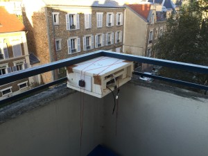
Made from extruded polystyrene. I followed the instructions from the UKHAS wiki. Here is how it looked like after we built it. It is sitting in our balcony for testing the transmission.

IMG_6519

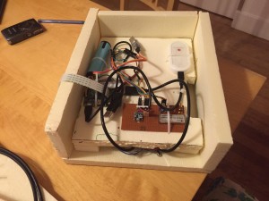
The guts of the payload looked like this:

Payload insides


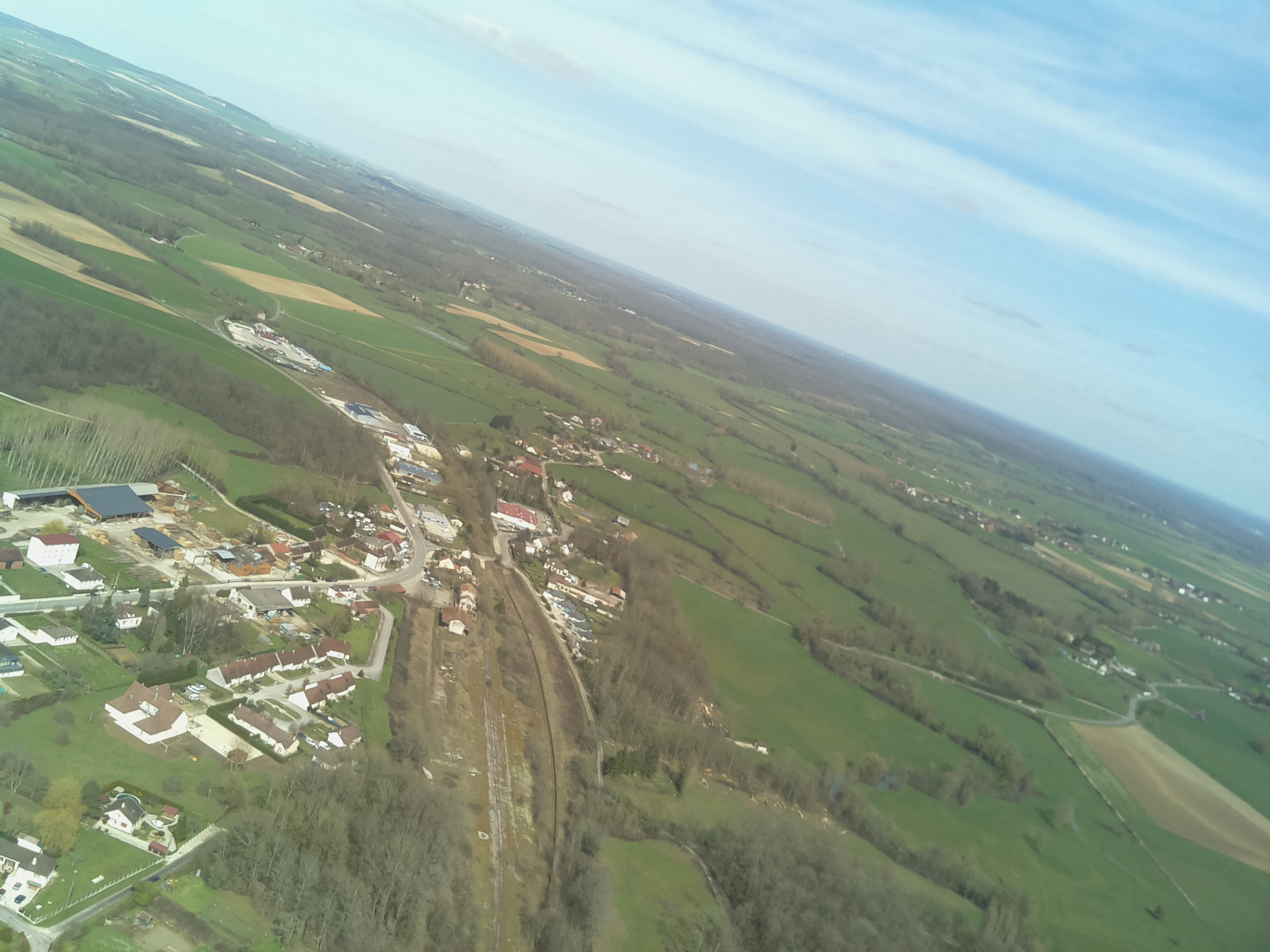
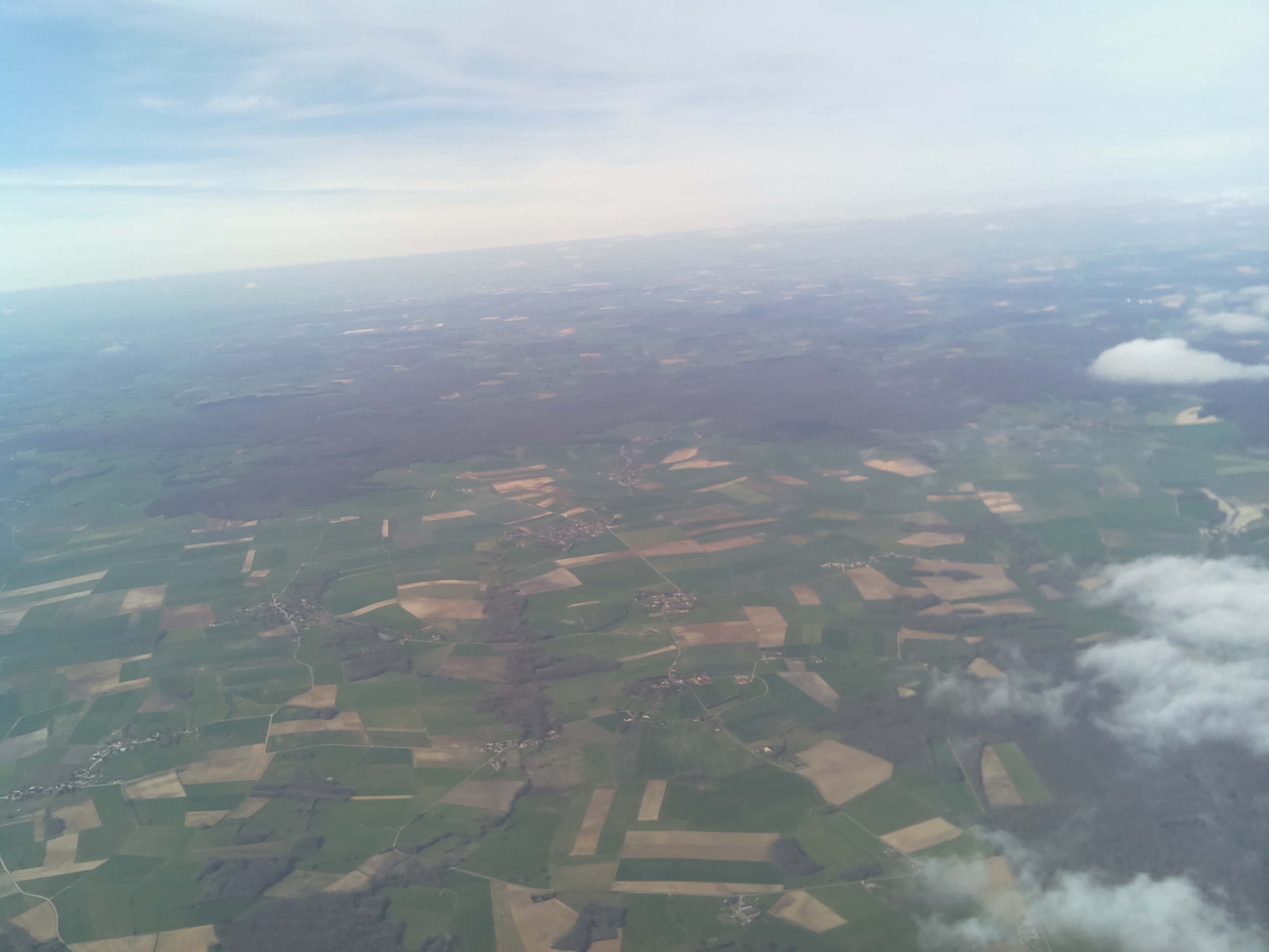
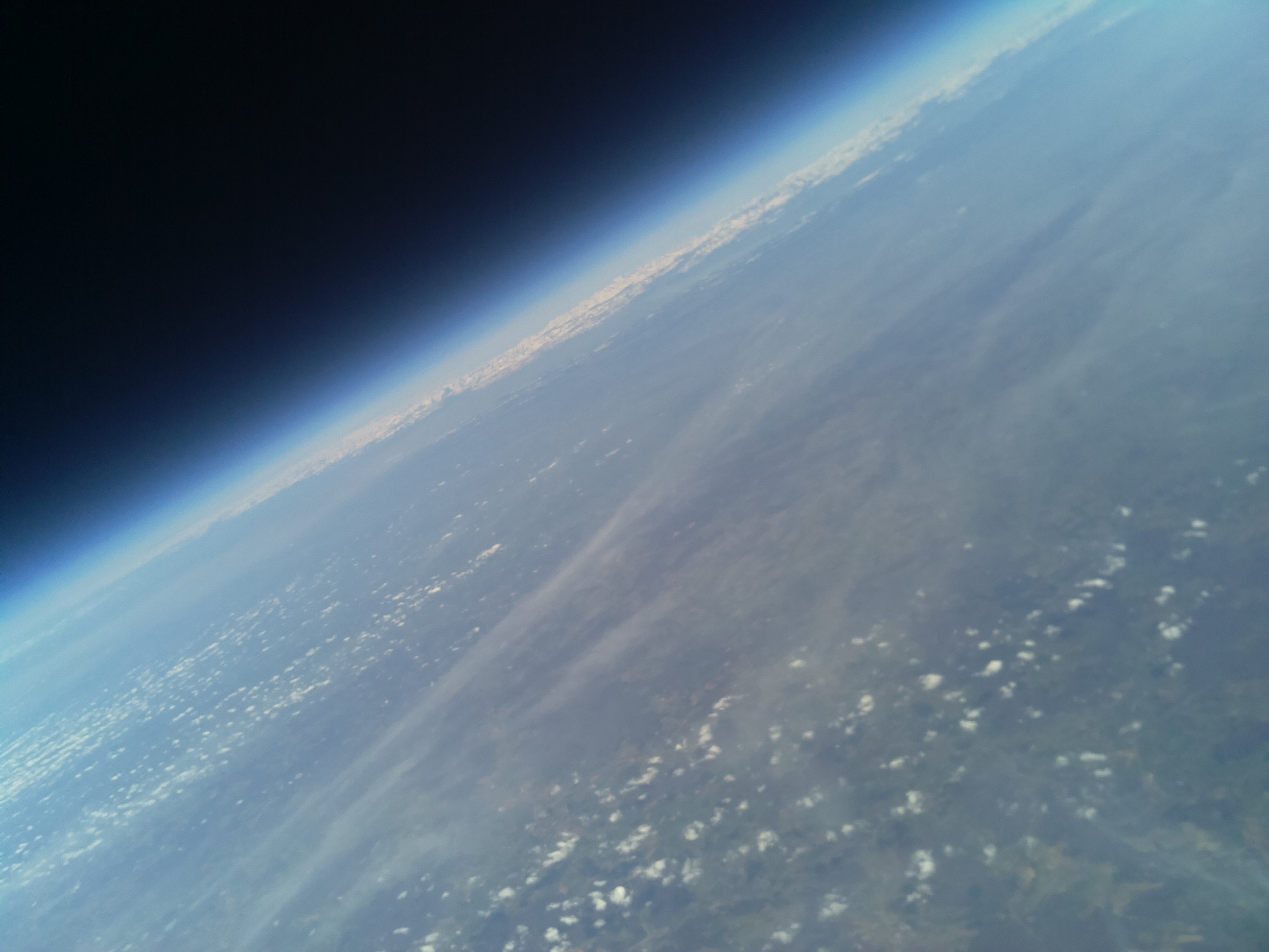
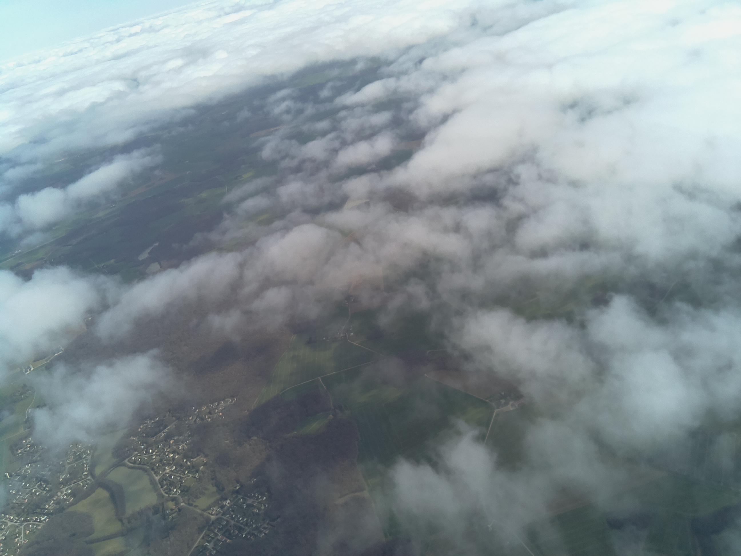
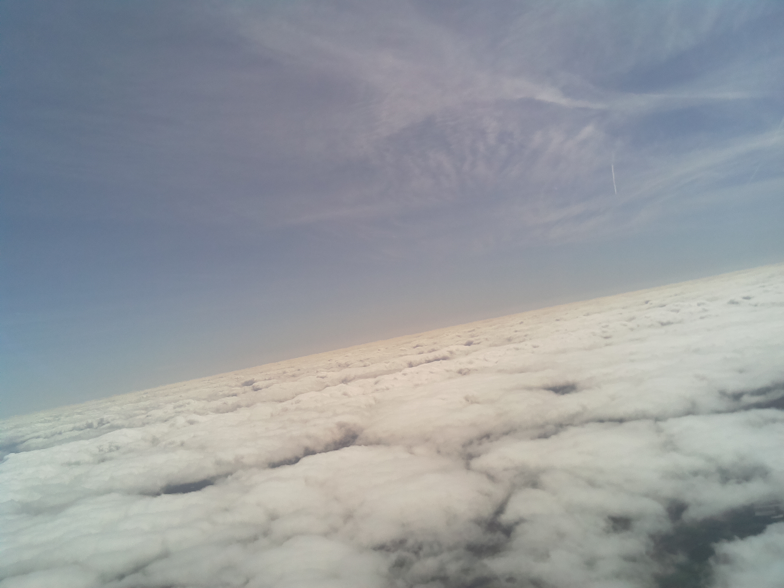
Finally here is a slideshow of some of pictures from the Pi camera:

More posts to come on what went into building the payload, test and learnings etc.

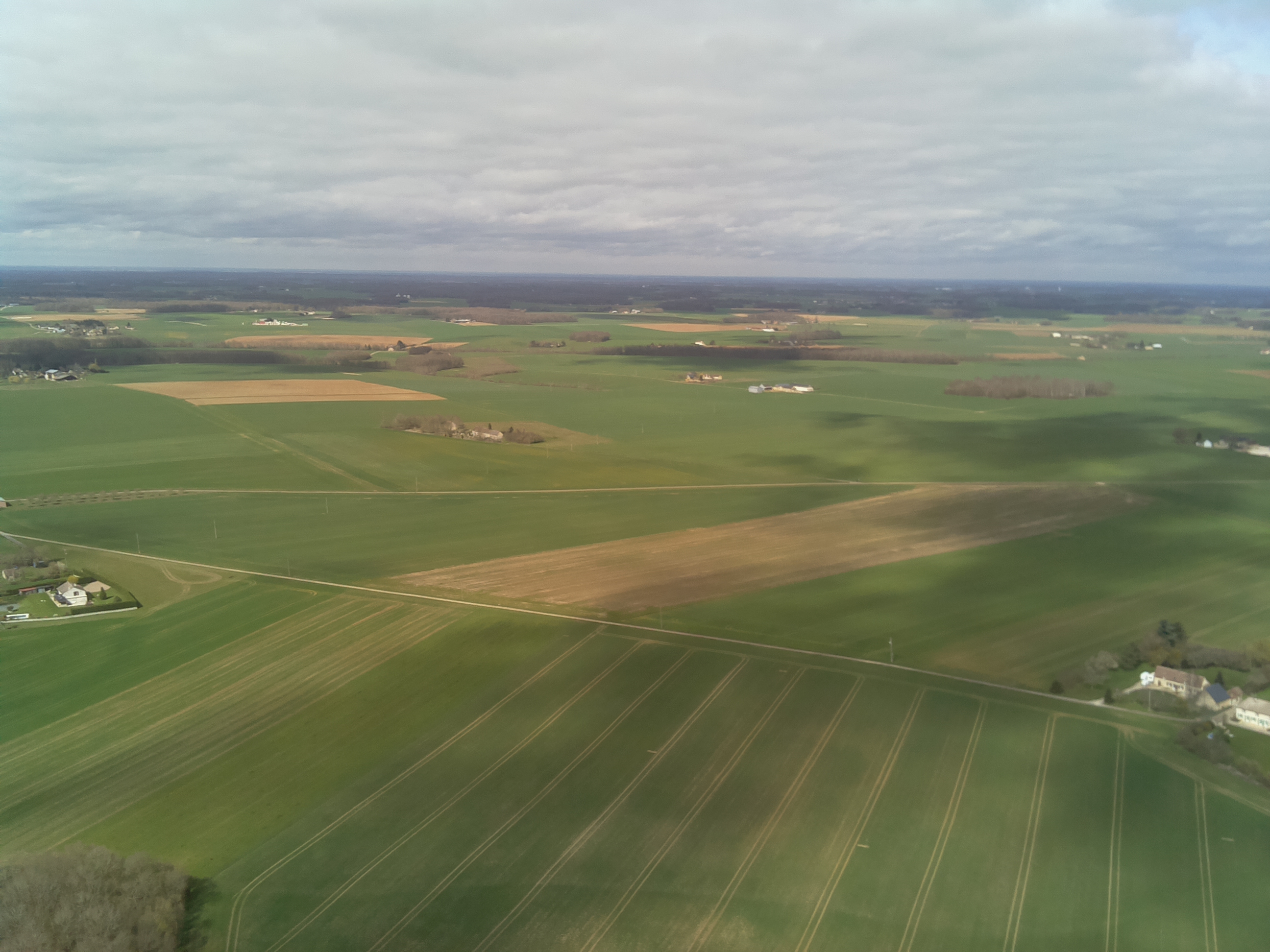
This launch was not done entirely by me. I stood on the shoulders of the giants at UKHAS. They were immensely helpful with their Wiki and being available on the IRC channel. I was also helped immensely by Yannick, who did the first amateur launch in France and knew all about the regulations. His house was also the site of the launch! Without Yannick looking over my shoulders, I would not have succeeded.